
Planning a backcountry adventure can be exhilarating—but without the right strategy, it can quickly become overwhelming. If you’re searching for clear, reliable guidance on wilderness exploration, trekking preparation, and wilderness route planning, this article is designed to give you exactly that. We break down practical navigation strategies, terrain assessment techniques, and gear considerations that help you move confidently and safely through remote environments.
Many outdoor enthusiasts struggle with choosing efficient routes, preparing for unpredictable conditions, and selecting gear that truly performs in the wild. Here, you’ll find actionable insights that simplify those decisions, whether you’re mapping a multi-day trek or exploring lesser-known terrain.
Our guidance is grounded in extensive field research, hands-on testing of survival gear, and proven outdoor methodologies. This article will equip you with smarter planning frameworks, risk-reduction strategies, and exploration tactics so you can approach your next wilderness journey prepared, informed, and ready for the unexpected.
From Trailhead to Summit: A Modern Guide to Route Planning
As you prepare for an unforgettable journey into the untamed wilderness, consider how the insights shared in our article on ‘Yiganlawi‘ can enhance your route planning strategies, ensuring a safer and more enjoyable expedition.
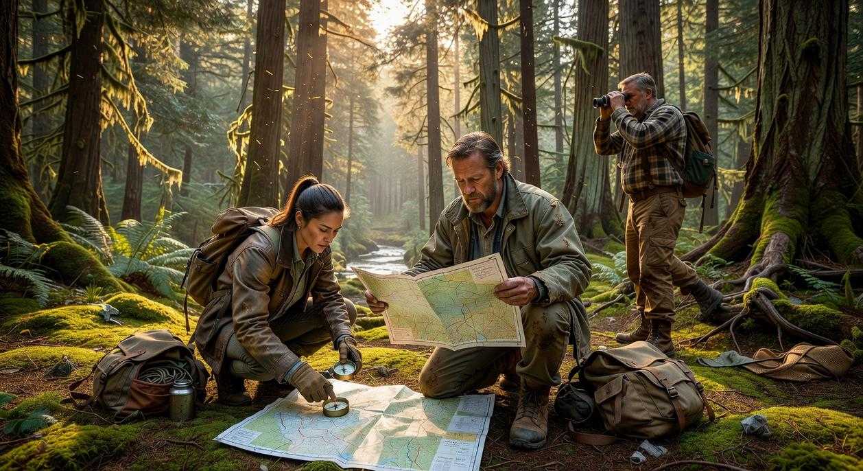
The difference between an epic story and a search-and-rescue callout usually comes down to preparation. Yet most guides swing to extremes: overbuilt GPS workflows or vague “just follow the trail” advice. Instead, start with terrain analysis (studying elevation, water sources, and bailout points), then layer timing, weather windows, and energy budgets.
Unlike generic checklists, this framework stress-tests your plan against failure: What if the creek is dry? What if pace drops 30%?
Finally, document decisions in a simple field card. That’s wilderness route planning made practical, repeatable, and resilient outdoors.
Step 1: Define Your Adventure Before You Touch a Map
Start With the Why
Before you trace a single contour line, decide what you actually want. Summit a peak? Reach a quiet alpine lake? Test your endurance? Or just disappear into solitude for a while? Your objective shapes everything that follows. In my opinion, most failed trips don’t collapse because of bad navigation—they unravel because the goal was fuzzy from the start.
Some hikers argue that spontaneity is the magic of the outdoors (and sure, wandering can feel poetic). But without a defined aim, you risk overextending, underpacking, or worse—dragging friends into a suffer-fest they didn’t sign up for.
Be honest about:
- Fitness levels (plan for the least experienced member, always)
- Gear quality and limitations
- Technical skills like navigation or river crossings
Next, study environmental factors. Spring snowpack, monsoon storms, limited daylight—these aren’t details, they’re decision-makers. The National Park Service regularly reports that weather shifts are a leading factor in backcountry incidents (nps.gov).
Set a clear timeline. A two-day window demands restraint; a week allows complexity. Smart wilderness route planning starts here—not on the map, but in your expectations. Pro tip: build in buffer time. Nature doesn’t care about your calendar.
Step 2: Choosing Your Navigation Toolkit
Before you hit the trail, you need to understand one simple idea: navigation works best in layers. Think of it like clothing in the backcountry—you don’t rely on just one jacket (unless you enjoy shivering at 10,000 feet).
Digital Tools (The Convenience Layer)
Apps like Gaia GPS, AllTrails, and CalTopo have transformed wilderness route planning. In plain terms, these are GPS-enabled mapping platforms that show your real-time location on detailed maps.
Their strengths are obvious. You get real-time tracking (your moving blue dot), user reports (recent trail conditions), and satellite imagery (overhead photos of terrain). According to a 2023 Outdoor Industry Association report, over 60% of hikers now use navigation apps on trail.
However, convenience has limits. Phones depend on battery life, and GPS signals can degrade in deep canyons or dense forests. Cold weather drains power faster (ask anyone who’s watched 40% drop to 2% in minutes). Some argue offline downloads solve everything. They help—but they don’t fix hardware failure.
Analog Tools (The Reliability Layer)
A topographic map shows elevation changes through contour lines, while a baseplate compass helps you determine direction using magnetic north.
Their biggest advantage? They don’t crash. They don’t need updates. They teach land association—the skill of matching what you see to the map. The downside is clear: they require practice. Without training, they’re just paper and plastic.
The Hybrid Approach
Here’s the clarification most beginners miss: it’s not digital versus analog. It’s digital and analog.
Use apps for macro-planning and quick checks. But rely on map and compass as your primary system and infallible backup. Technology is brilliant—until it isn’t.
Step 3: Charting Your Course, Mile by Mile
Now we get to the part that separates casual walkers from confident navigators.
Mastering Topographic Maps
First, contour lines. These thin, looping lines show elevation. When they’re tightly packed, the terrain is steep; when spaced wide apart, the ground is gentler. Think of it like a stack of pancakes: the closer the layers, the steeper the climb. Closed circles usually mark summits, while V-shaped contours pointing uphill reveal valleys (the V points upstream). Ridges form where contours bulge outward. Once you see it, you can’t unsee it.
Some hikers argue GPS makes this skill obsolete. I disagree. Batteries die. Signals drift. A paper map builds real spatial awareness—and confidence.
Identifying Critical Points
Next, mark key waypoints: trail junctions, dependable water sources, potential campsites, and bailout points (pre-planned exit routes if conditions sour). I always circle water in blue and highlight escape routes in red. It’s a small habit that pays off when fatigue sets in.
This is the backbone of smart wilderness route planning.
Calculating Your Pace
Use a simplified Naismith’s Rule: allow 1 hour for every 3 miles, plus 1 hour for every 2,000 feet of elevation gain (Scottish mountaineer William Naismith proposed this in 1892). It’s not perfect, but it’s a solid baseline.
Building in Buffers
Then—and this is crucial—add extra time. Breaks, navigation checks, photos, weather shifts. I typically add 20–30%. Optimistic schedules look great on paper; realistic ones get you home safely.
For deeper preparation, review risk assessment techniques for backcountry travel before you go.
Step 4: The Pre-Hike Briefing and Your Safety Net
Think of this as your FINAL CHECKPOINT before boots hit dirt. A conditions check means reviewing the latest weather forecast, ranger station updates, trail closures, and wildlife or fire advisories. Conditions change fast; yesterday’s sunshine can become today’s storm.
Next, create a detailed itinerary:
- Planned route
- Start and end times
- Vehicle description and plate
- Names of everyone in your group
This is basic wilderness route planning—clear, written, specific.
Finally, share it with someone reliable and set a firm “call for help” time. (Yes, like your own mini mission briefing.) Clarity saves lives.
Blueprint in Action
Meticulous planning doesn’t eliminate adventure; it fuels it. Research from the Outdoor Industry Association shows that prepared hikers report higher trip satisfaction and fewer emergencies. That confidence is earned, not accidental.
Poor planning breeds uncertainty, wasted miles, and preventable risks. This framework turns chaos into a repeatable system. Think of wilderness route planning as your GPS for judgment (not just direction).
- Define your terrain and limits.
- Toolkit check gear against conditions.
- Plot realistic mileage and exits.
- Check forecasts and contingencies.
Plan a short local hike this weekend and test it. Build lasting confidence now.
Take Your Next Step Into the Wild With Confidence
You came here looking for clarity—how to explore smarter, trek safer, and approach the outdoors with real strategy instead of guesswork. Now you understand the core principles behind preparation, gear selection, terrain assessment, and wilderness route planning that separates confident adventurers from unprepared hikers.
The biggest risk in the wild isn’t the terrain—it’s uncertainty. Poor planning, overlooked gear, and unclear routes can turn an exciting trek into a stressful, even dangerous situation. You don’t want second‑guessing when you’re miles from civilization.
The solution is simple: keep sharpening your strategy before you step onto the trail. Dive deeper into proven trekking guides, refine your survival systems, and apply structured route planning every time you head out.
Thousands of outdoor enthusiasts rely on our field-tested insights to explore with confidence. If you’re ready to eliminate doubt and elevate every expedition, start implementing these strategies on your next adventure—and prepare like a pro before you go.
 Elvric Xelvaris is the kind of writer who genuinely cannot publish something without checking it twice. Maybe three times. They came to wilderness exploration strategies through years of hands-on work rather than theory, which means the things they writes about — Wilderness Exploration Strategies, Horizon Headlines, Jaroconca Trekking Guides, among other areas — are things they has actually tested, questioned, and revised opinions on more than once.
That shows in the work. Elvric's pieces tend to go a level deeper than most. Not in a way that becomes unreadable, but in a way that makes you realize you'd been missing something important. They has a habit of finding the detail that everybody else glosses over and making it the center of the story — which sounds simple, but takes a rare combination of curiosity and patience to pull off consistently. The writing never feels rushed. It feels like someone who sat with the subject long enough to actually understand it.
Outside of specific topics, what Elvric cares about most is whether the reader walks away with something useful. Not impressed. Not entertained. Useful. That's a harder bar to clear than it sounds, and they clears it more often than not — which is why readers tend to remember Elvric's articles long after they've forgotten the headline.
Elvric Xelvaris is the kind of writer who genuinely cannot publish something without checking it twice. Maybe three times. They came to wilderness exploration strategies through years of hands-on work rather than theory, which means the things they writes about — Wilderness Exploration Strategies, Horizon Headlines, Jaroconca Trekking Guides, among other areas — are things they has actually tested, questioned, and revised opinions on more than once.
That shows in the work. Elvric's pieces tend to go a level deeper than most. Not in a way that becomes unreadable, but in a way that makes you realize you'd been missing something important. They has a habit of finding the detail that everybody else glosses over and making it the center of the story — which sounds simple, but takes a rare combination of curiosity and patience to pull off consistently. The writing never feels rushed. It feels like someone who sat with the subject long enough to actually understand it.
Outside of specific topics, what Elvric cares about most is whether the reader walks away with something useful. Not impressed. Not entertained. Useful. That's a harder bar to clear than it sounds, and they clears it more often than not — which is why readers tend to remember Elvric's articles long after they've forgotten the headline.