
Planning a wilderness adventure is exciting—but without the right preparation, it can quickly become dangerous. If you’re searching for practical strategies to explore the outdoors safely, choose reliable gear, and navigate unpredictable terrain with confidence, you’re in the right place. This guide is designed to help trekkers, backpackers, and wilderness enthusiasts make smarter decisions before and during their journeys.
We’ve built this resource using field-tested exploration methods, proven survival principles, and insights drawn from experienced backcountry travelers who understand what truly works beyond marked trails. From essential gear hacks to route planning and backcountry risk assessment, every section focuses on helping you reduce uncertainty and increase self-reliance in remote environments.
Whether you’re preparing for your first multi-day trek or refining your wilderness strategy, this article delivers clear, actionable guidance to help you explore farther—while staying prepared for what the wild can bring.
Beyond the Trailhead: Understanding the True Nature of Backcountry Risk
The allure of untouched wilderness is powerful, yet it hides an unforgiving reality. So, consider Scenario A versus Scenario B. A prepares for rain; B prepares for rain, fatigue, and navigation errors. At first glance, both seem cautious. However, when weather shifts, A gets wet; when weather, darkness, and hunger collide, B adapts. Small stressors stack like dominoes (yes, the wilderness plays for keeps). That’s where backcountry risk assessment changes the game. Instead of isolated checklists, you map connections. For example, a twisted ankle plus fading light plus low morale equals exponential danger. Pro tip: plan for combinations, not villains.
The Unpredictable Elements: Mastering Environmental Risk Assessment
Great adventures aren’t ruined by the expected—they’re derailed by what you didn’t see coming. Mastering environmental awareness gives you control, confidence, and fewer “why did I do that?” moments.
Weather Systems
Daily forecasts are broad predictions, not mountain truths. Microclimates—localized weather pockets shaped by terrain—can turn a sunny trailhead into a freezing ridgeline. Temperature drops roughly 3.5°F per 1,000 feet of elevation gain (NOAA), accelerating hypothermia risk even in summer. Conversely, exposed desert canyons magnify heat, fast-tracking dehydration and heat exhaustion. Understanding these shifts improves layering decisions, pacing, and turnaround timing—key pillars of backcountry risk assessment.
Terrain Hazards
A topographic map is more than squiggly lines. Closely spaced contours signal steep slopes; bowl-shaped formations may mark avalanche chutes—even without snow. River crossings that look calm can hide swift currents and unstable footing. The benefit? Smarter route choices:
- Avoiding loose scree that increases fall risk
- Identifying safer switchbacks over direct ascents
- Spotting narrow canyon “pinch points” prone to flash floods
Often, the “easiest” path is simply the most obvious—not the safest.
Wildlife Encounters
Prevention beats reaction. Proper food storage, consistent noise in dense brush, and alert observation reduce surprise encounters. You gain peace of mind—and keep wild places truly wild (which is the point, after all).
The Human Factor: Analyzing Your Group’s Weakest Link
Every expedition plan looks solid on paper. However, the real variable isn’t the map or the weather report—it’s the people.
Physical and Technical Proficiency
Start with an honest audit. Physical proficiency means matching strength, endurance, and mobility to the terrain’s demands—not just gym fitness. A 10-mile hike with 3,000 feet of elevation gain stresses joints and lungs differently than a treadmill session. Likewise, technical proficiency includes navigation (map, compass, GPS redundancy), first-aid competence, and gear familiarity. If one member can’t interpret contour lines or treat hypothermia, that’s not a minor gap—it’s a liability.
Some argue that strong leadership compensates for weaker skills. Sometimes it does. Yet overreliance breeds exhaustion and bottlenecks. A balanced team distributes load—literally and strategically. Pro tip: run a short “shakedown” hike before major trips to surface weaknesses early.
Psychological Pressures
Even skilled hikers falter mentally. Summit fever—the irrational push to reach the goal despite worsening conditions—has been cited in numerous mountaineering accidents (American Alpine Club reports). Meanwhile, familiarity bias makes routine trails feel “safe,” lowering vigilance. Then there’s panic: a stress response that narrows thinking and freezes action.
This is where backcountry risk assessment becomes essential. Anticipating emotional triggers reduces their power. If you haven’t studied how to build mental resilience for extreme outdoor challenges, you’re leaving a critical skill undeveloped.
Group Dynamics
Finally, communication. Mismatched expectations—pace, risk tolerance, turnaround times—fracture teams quickly. Define leadership roles and decision protocols before departure. Democracy is great at camp; in a storm, clarity saves lives. (Yes, even your most experienced friend needs boundaries.)
In the wilderness, the weakest link isn’t an insult. It’s a responsibility to identify—and strengthen—before the trail does it for you.
A Systems-Based Approach to Your Equipment
The classic “Ten Essentials” list is helpful. However, treating gear as a checklist can create a false sense of security. A systems-based approach reframes equipment as interconnected safety networks: a Shelter System (tent, insulation, repair kit), Hydration System (water source, filter, backup purification), and Navigation System (map, compass, GPS).
Systems vs. Single Points of Failure
Consider Filter A vs. Filter B thinking. Filter A works perfectly—until it clogs. Filter B is a layered system: primary filter plus chemical tabs as backup. The difference isn’t brand; it’s redundancy. The same applies to stoves (canister-only vs. canister + fire-starting backup) and lighting (headlamp alone vs. headlamp + spare batteries).
Critics argue redundancy adds weight. Fair. Ounces matter. Yet backcountry risk assessment consistently shows that small failures cascade quickly in remote terrain (and no one brags about the ultralight setup that left them cold and thirsty).
Now compare GPS-only navigation vs. map-and-compass proficiency. GPS is fast and precise—until batteries die or signals drop. A paper map doesn’t crash. Mastery of analog navigation isn’t nostalgic; it’s failure-proof.
Ultimately, systems thinking shifts the question from “Do I have it?” to “What happens if it fails?” That mindset, more than any gadget, keeps you moving safely.
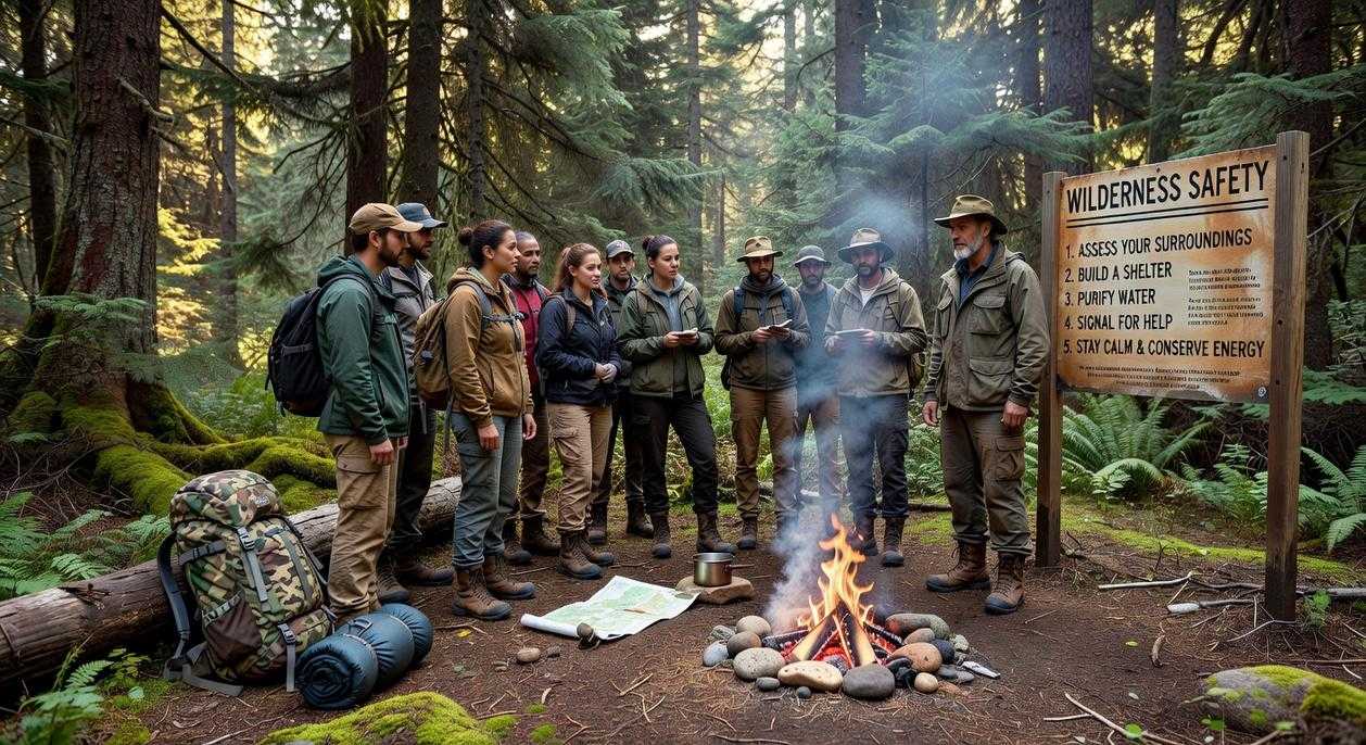
Building a Proactive Mitigation and Response Plan
A trip plan isn’t paperwork; it’s your lifeline. Leave a detailed route map, planned campsites, bailout options (alternate exits if conditions turn), and strict check-in times with a trusted contact. Think of it as your own Mission: Impossible briefing—except if you miss a check-in, it doesn’t self-destruct; it triggers help.
Next, practice “what-if” scenario planning. What if you sprain an ankle five miles from the trailhead? What if fog rolls in and landmarks vanish? Walking through these scenarios sharpens backcountry risk assessment and prevents panic-driven decisions.
When it comes to emergency communication, know your tools. A Personal Locator Beacon (PLB) sends a one-way SOS to search and rescue—no small talk, just coordinates. A satellite messenger, by contrast, allows two-way texts and updates. Ideally, use both: one for worst-case rescue, one for evolving situations (because this isn’t Survivor). Plan smartly before boots hit dirt.
Risk in the backcountry can never be erased; it can only be understood. Some argue that safety means eliminating every hazard, but that belief creates paralysis, not protection. TRUE preparedness comes from structured backcountry risk assessment and honest self-evaluation. When you analyze conditions, decision-making, and equipment, fear shifts into focus.
Consider:
- Environmental factors like weather and terrain
- Human limits, fatigue, communication
- Gear reliability and redundancy
Skeptics say this overcomplicates adventure. I disagree. Planning is FREEDOM, not fear. Study maps, review forecasts, test tools, and explore resources like this guide https://example.com. Make preparation the most critical mile.
When planning your backcountry adventure, especially if you’re considering a trek to stunning destinations like Havajazon Waterfall, understanding risk assessment techniques is essential to ensure a safe and enjoyable experience – for more details, check out our To Visit Havajazon Waterfall.
Take Control of Every Step You Take Outdoors
You set out to better understand how to prepare, plan, and protect yourself in the wild—and now you have a clearer path forward. From route planning and gear selection to mastering backcountry risk assessment, you’re better equipped to make smart, confident decisions before and during every trek.
The truth is, uncertainty in the wilderness is what turns adventure into danger. Not knowing how to evaluate terrain, weather shifts, or emergency scenarios can cost you more than just comfort—it can put your safety at risk. That’s the pain point most explorers face: loving the wild but underestimating its unpredictability.
Now it’s time to act. Apply what you’ve learned. Review your current gear setup. Reassess your planning process. Sharpen your decision-making framework before your next outing.
If you’re serious about exploring smarter and safer, dive deeper into our proven trekking strategies and field-tested survival insights. We’re trusted by thousands of outdoor enthusiasts who want practical, real-world guidance—not guesswork. Start preparing today so your next adventure is defined by confidence, not crisis.
 There is a specific skill involved in explaining something clearly — one that is completely separate from actually knowing the subject. Anthony Earponyo has both. They has spent years working with horizon headlines in a hands-on capacity, and an equal amount of time figuring out how to translate that experience into writing that people with different backgrounds can actually absorb and use.
Anthony tends to approach complex subjects — Horizon Headlines, Jaroconca Trekking Guides, Niche Explorations being good examples — by starting with what the reader already knows, then building outward from there rather than dropping them in the deep end. It sounds like a small thing. In practice it makes a significant difference in whether someone finishes the article or abandons it halfway through. They is also good at knowing when to stop — a surprisingly underrated skill. Some writers bury useful information under so many caveats and qualifications that the point disappears. Anthony knows where the point is and gets there without too many detours.
The practical effect of all this is that people who read Anthony's work tend to come away actually capable of doing something with it. Not just vaguely informed — actually capable. For a writer working in horizon headlines, that is probably the best possible outcome, and it's the standard Anthony holds they's own work to.
There is a specific skill involved in explaining something clearly — one that is completely separate from actually knowing the subject. Anthony Earponyo has both. They has spent years working with horizon headlines in a hands-on capacity, and an equal amount of time figuring out how to translate that experience into writing that people with different backgrounds can actually absorb and use.
Anthony tends to approach complex subjects — Horizon Headlines, Jaroconca Trekking Guides, Niche Explorations being good examples — by starting with what the reader already knows, then building outward from there rather than dropping them in the deep end. It sounds like a small thing. In practice it makes a significant difference in whether someone finishes the article or abandons it halfway through. They is also good at knowing when to stop — a surprisingly underrated skill. Some writers bury useful information under so many caveats and qualifications that the point disappears. Anthony knows where the point is and gets there without too many detours.
The practical effect of all this is that people who read Anthony's work tend to come away actually capable of doing something with it. Not just vaguely informed — actually capable. For a writer working in horizon headlines, that is probably the best possible outcome, and it's the standard Anthony holds they's own work to.